Registration  :   Пользователь: Пароль:

Download


Product Version Summary Citation Download File Size Metadata Quicklook
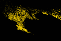
TerraNorte Arable Lands of Russia Version 3 Sergey A. Bartalev, Dmitry E. Plotnikov and Evgeny A. Loupian (2016) Mapping of arable land in Russia using multi-year time series of MODIS data and the LAGMA classification technique, Remote Sensing Letters, Vol. 7, No. 3, 269-278, DOI: 10.1080/2150704X.2015.1130874 Erdas Imagine (SIN)
Binary (SIN)
Erdas Imagine (Lat/Lon)
Binary (Lat/Lon)
2.85 Mb
3.34 Mb
3.68 Mb
3.91 Mb
General metadata
SIN map details
Lat/Lon map details


X

Summary


The arable land mapping method is developed based on multi-year time series of Moderate Resolution Imaging Spectroradiometer (MODIS) data. The method exploits differences between the intra- and interannual changes in the spectral reflectance of arable land and the corresponding changes for other land cover types. It involves a set of satellite data-derived phenological metrics generated using a 6 years long time series of the perpendicular vegetation index (PVI). The approach utilizes the Locally Adaptive Global Mapping Algorithm (LAGMA), which is a supervised classification technique accounting for the spatial variability of intra-classes spectral properties.

X

General metadata


TerraNorte Arable Lands product is distributed in a ZIP archive named as following: alrus_[PRJ]_[AABB]_[R][U]_v[X]_[F].zip


Erdas Imagine data files:

alrus_[PRJ]_[AABB]_[R][U]_v[X].img  &  alrus_[PRJ]_[AABB]_[R][U]_v[X].rrd


Binary file:

alrus_[PRJ]_[AABB]_[R][U]_v[X].bin


Product and filename nomenclature:

PRJ

map projection, one of the following:
SIN – Sinusoidal, WGS 84
GEO – Geographical(Lat/Lon), WGS 84

AA

start of 6-year interval (2 digits)

BB

end of 6-year interval (2 digits)

R

product spatial resolution

U

map units ("m" for meters and "deg" for degrees)

X

version number

F

file format ("img" for ERDAS and "bin" for BINARY)

X

Map details for SIN


Upper Y
7783653.63766 m

Left X
1111950.51966  m

Right X
11119273.540309 m

Lower Y
4448033.735025 m

Note: these values are associated with the center of the pixel.


Datum/spheroid

WGS84

Pixel size

231.656358 m

Width (cols)

43200

Height (rows)

14400

Bits

1 bit for IMG
8 bit for BIN

X

Map details for Lat/Lon


Upper Y
65.0

Left X
19.0

Right X
144.5

Lower Y
41.0

Note: these values are associated with the center of the pixel.


Datum/spheroid

WGS84

Pixel size

0.002 deg

Width (cols)

62750

Height (rows)

12000

Bits

1 bit for IMG
8 bit for BIN